Surveying instruments are the tools a crew uses to measure angles, distances, heights and positions on the ground, and a working Pakistani crew carries about fifteen of them. The core set, a total station, an auto level and a GNSS receiver, costs anything from PKR 60,000 for a level kit to well over PKR 2,000,000 for a full RTK set.
This guide lists every instrument you will meet on a site or in a tender schedule, says in one line what each one measures, gives a realistic accuracy and an indicative 2026 market price, and explains which ones a contractor, a survey firm or a consultant actually needs. It is written from the counter and the service bench in Rawalpindi, where we have sold and repaired these instruments since 2002.
What are the 15 surveying instruments?
The fifteen instruments below cover almost every land, construction and mapping survey done in Pakistan. Indicative market ranges for new equipment in October 2026. Confirm today's price on WhatsApp, rates move with the exchange rate.
| Instrument | What it measures | Typical accuracy | Indicative market price (PKR) |
|---|---|---|---|
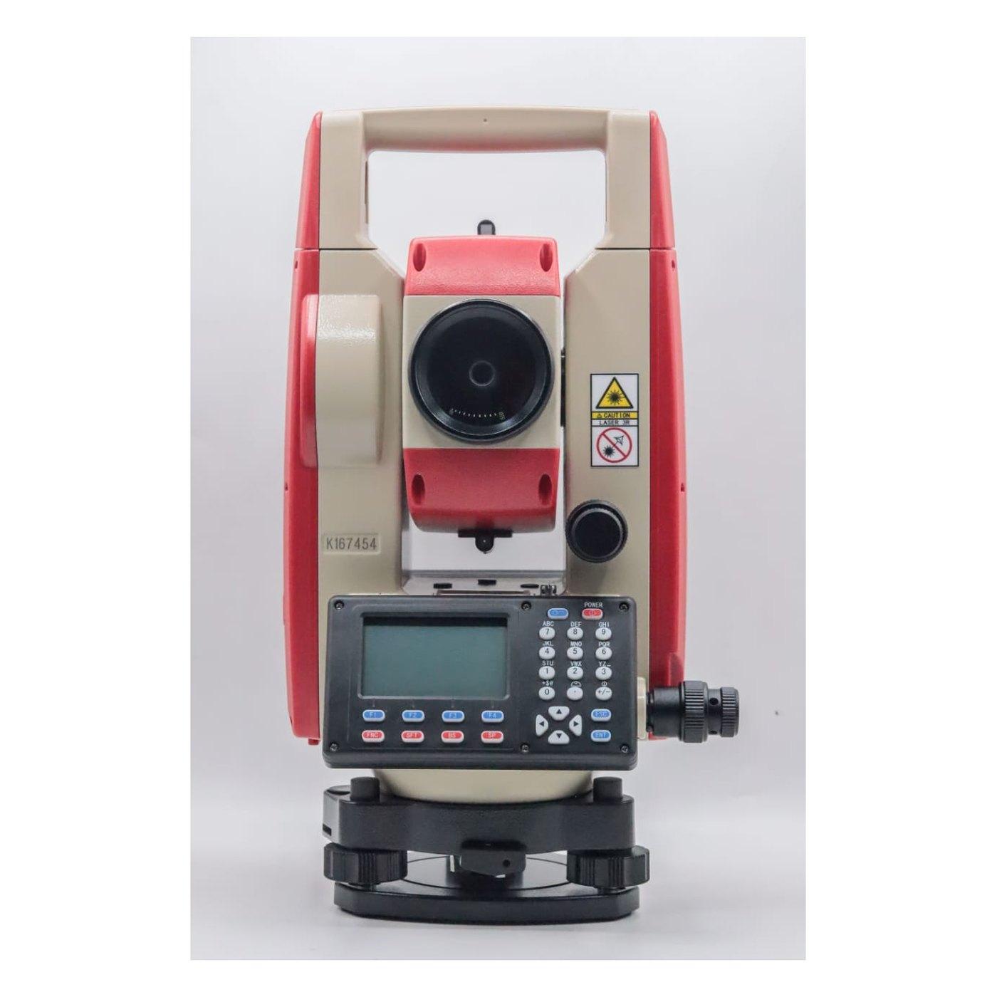
| Total station | Horizontal and vertical angles plus distance, giving coordinates | 2 seconds; 2 mm + 2 ppm to a prism | 450,000 to 1,200,000 (Kolida KTS-442P set: 500,000, our price) |
| Auto level | Height differences against a staff | 1.5 to 2.5 mm per km double run | 25,000 to 120,000 |
| Theodolite, digital or optical | Horizontal and vertical angles only | 2 to 20 seconds | 90,000 to 250,000 |
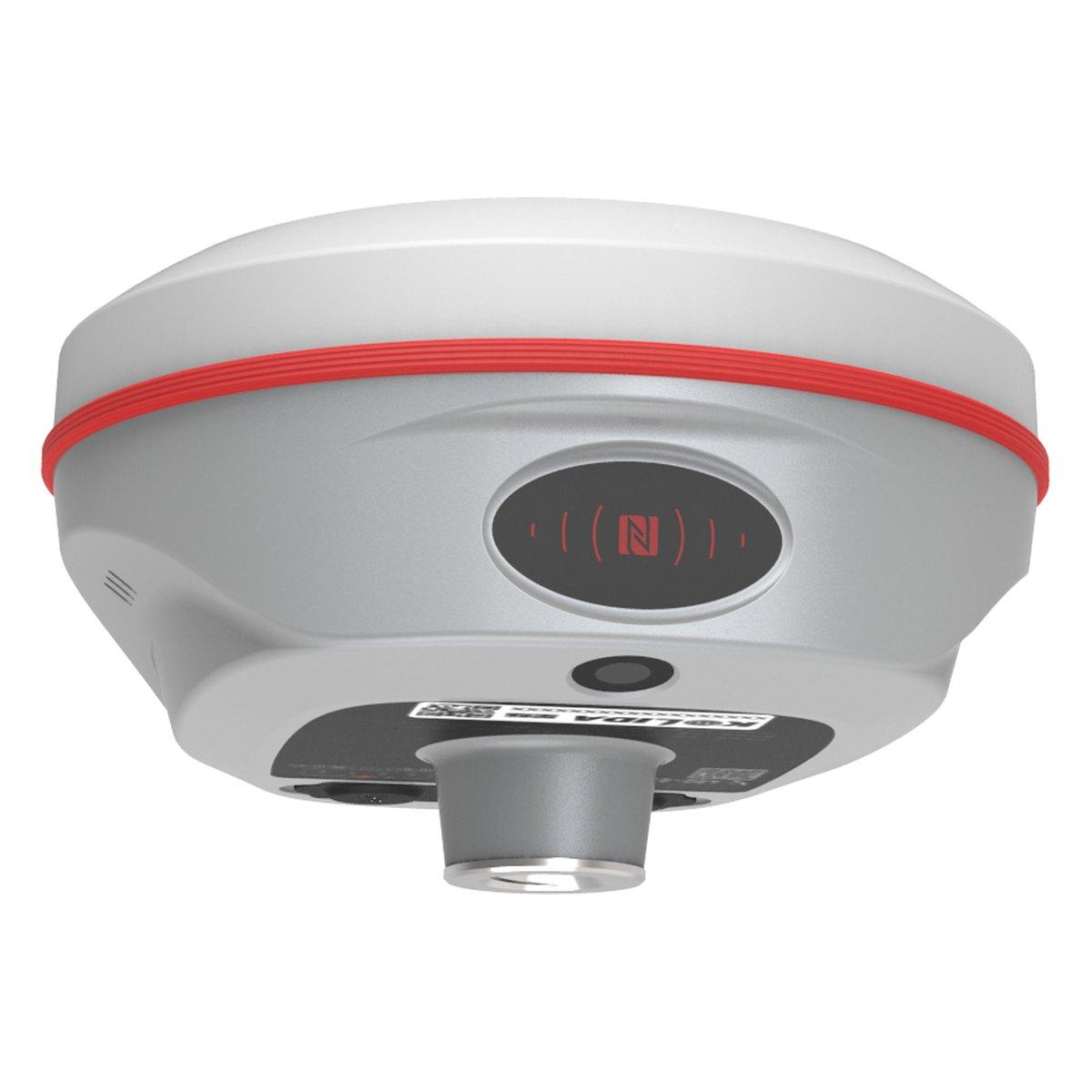
| GNSS RTK receiver | Position from satellites, real time | About 1 to 2 cm horizontal | 600,000 to 3,500,000 per set |
| Rotary laser level | A level plane over a whole site | About 1.5 mm at 30 m | 45,000 to 60,000 Chinese; 150,000 and up branded |
| Line or cross laser | Level and plumb lines indoors | 2 to 3 mm at 10 m | 8,000 to 60,000 |
| Levelling staff | The height reading for the level | Graduated to 5 or 10 mm, read to 1 mm | 6,000 to 18,000 |
| Prism, pole and target | The reflector a total station measures to | Depends on the prism constant being set | 15,000 to 45,000 |
| Survey tripod | A stable base for the instrument | Stability only | 8,000 to 25,000 |
| Tribrach | Levels and centres the instrument or prism over a mark | Optical plummet about 0.5 mm at 1.5 m | 8,000 to 30,000 |
| Handheld GPS | Approximate position and track | 3 to 5 m | 40,000 to 150,000 |
| Laser distance meter | Short distances, areas and volumes | 1.5 to 2 mm | 5,000 to 60,000 |
| Measuring tape and chain | Linear distance by hand | A few mm per 30 m with care | 1,000 to 8,000 |
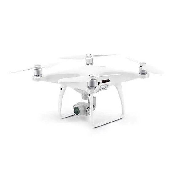
| Survey and mapping drone | Orthomosaic, terrain model and volumes from the air | 3 to 5 cm horizontal with ground control | 1,500,000 to 8,000,000 |
| 3D laser scanner | A dense point cloud of a structure or site | 1 to 3 cm relative, handheld class | 3,500,000 to 10,000,000 |
| Compass, geological or prismatic | Bearing, and for geologists strike and dip | 0.5 to 1 degree | 10,000 to 200,000 |
Two things stand out. Accessories make up a large share of the list: a total station is useless without a tripod, tribrach and prism. And the price spread inside each line is mostly brand and origin, not capability. A Chinese and a Japanese 2 second total station meet the same paper specification; the difference is optics, durability and how long the compensator stays in adjustment.
Which instrument is used in surveying?
The five instruments used on almost every survey are the total station, the auto level, the theodolite, the GNSS receiver and the levelling staff. Everything else on the list supports one of these or does a specialist version of its job.
- Total station: setting out, control traverses and as-built detail. Prices and brands are in total station price in Pakistan, and model choice in the best total station for surveying in Pakistan.
- Auto level: the cheapest instrument here and still the most accurate for heights on site. See auto level price in Pakistan.
- Theodolite: angles only, for tower erection, column setting out and training institutes. See theodolite price in Pakistan.
- GNSS RTK receiver: centimetre coordinates without line of sight, now standard for open-ground topography and plot demarcation. See RTK GPS and GNSS receiver price in Pakistan.
- Levelling staff: every height the level produces is read from it, which is why it belongs in the five.
The instrument then follows the job. A house plot needs a level, staff and tape, with a total station or GNSS for the corners. Building grids need a total station, with a line laser for plumbing. Slabs and drainage falls need a rotary laser checked with the level; see laser level price in Pakistan. A housing society or road needs GNSS for open ground, a total station under trees and a drone above about 25 acres. Interiors need a laser distance meter or, for full models, a 3D scanner.
NHA, NESPAK and most consultants specify the instrument class in the tender, usually a 2 or 5 second total station and a dual-frequency GNSS, with a calibration certificate dated inside twelve months. Check the schedule before buying, because the cheapest instrument that fails the specification is the most expensive one you can own.
How much does a set of surveying instruments cost in Pakistan?
A basic levelling kit of auto level, tripod and 5 metre staff costs about PKR 60,000 to 100,000 in the 2026 market. A total station kit, meaning the instrument, a second tripod, a prism with tribrach and a pole, comes to roughly PKR 520,000 to 600,000 on a Kolida KTS-442P, whose complete set is PKR 500,000 from us as of August 2026, and well over PKR 1,000,000 on a Sokkia. A Chinese GNSS base and rover set adds PKR 1,200,000 to 2,500,000.
So a small survey firm in Rawalpindi or Lahore that wants to take on society and road work needs about PKR 2,000,000 to 3,000,000 of instruments before it owns a drone. That is why most start with a level and a total station, hire GNSS for the first large job, and buy it once the work repeats.
Exchange rate is the main driver. Every instrument on this list is imported, and with the dollar at about PKR 280 to 285, a move of a few rupees shifts a GNSS set by tens of thousands. Prices quoted in the market are usually valid for a week.
What is a distomat surveying instrument?
A distomat is an electronic distance meter, the name coming from the Wild Distomat that sat on top of a theodolite in the 1970s and 1980s. Older engineers in Pakistan still call any EDM a distomat. Today the distance meter is built into every total station, so a separate distomat is rarely sold.
On some sites the word is also used for a handheld laser distance meter, the pocket tool a quantity surveyor carries for room dimensions. That is a different class: accurate to about 2 mm over a few tens of metres indoors, but it cannot be centred over a mark or measure to a prism kilometres away. If a tender or an old drawing mentions a distomat, it means a total station or EDM measurement.
What are the main types of surveying, and which instruments do they use?
The main types of surveying are classified by purpose, and each leans on a different part of the instrument list:
- Topographic survey: total station, GNSS, drone.
- Cadastral or boundary survey: GNSS and total station, tied to revenue records.
- Construction survey: total station, auto level, laser.
- Route survey for roads, canals and pipelines: GNSS control, then drone or total station.
- Hydrographic survey: GNSS with an echo sounder, for rivers, dams and canals.
- Mining survey: total station, GNSS, drone and compass.
- Geodetic control survey: static GNSS.
- Aerial survey: drones with RTK or ground control, covered in our drone survey cost guide.
- Building and as-built survey: laser distance meter and 3D laser scanner.
- Geophysical and groundwater survey: resistivity instruments rather than optical ones, described in our land survey services guide.
The 30 millimetre mistake we see on the bench
Most instruments that come back to our Rawalpindi bench as "inaccurate" are not faulty. The most common cause is the prism constant. A standard survey prism on a tribrach carrier is set to a minus 30 mm offset, while many mini prisms and reflective sheets are 0 mm. If the total station is set for one and the crew measures to the other, every distance is wrong by 30 mm, consistently, and the traverse still looks tidy.
The field check takes two minutes. Measure the same short distance, about 20 to 30 metres, to the prism and then with a steel tape. If the two disagree by roughly 30 mm, the constant is wrong, not the instrument. The second most common cause is a levelling staff with a top section not clicked fully home, which reads 5 to 10 mm short on every reading above the joint. Pull every section to its stop and look at the joint numbers before blaming the level.
Heat and dust do the rest. Pakistani summer sun at 45 degrees pulls auto level compensators out of adjustment faster than a temperate climate does, so run a two-peg test monthly in summer, and keep battery contacts clean, because dust on the contacts causes more total station shutdowns than any electronics fault.
What we supply
We are authorised for Kolida and Sokkia and hold the full surveying range in Rawalpindi, with calibration certificates and delivery across Pakistan.
- Kolida KTS-442P total station: reflectorless, supplied with tribrach, battery, charger and case, PKR 500,000 complete set.
- Sokkia iM series total station: Japanese optics, 2 to 5 second models, up to 500 m reflectorless.
- Orion+ automatic level: sold as a set with tripod and staff.
- Kolida KT series digital theodolite: 2 and 5 second models for angle work.
- Kolida K6 GNSS RTK receiver: 1598 channels, IMU tilt to 60 degrees.
- Rotary laser level, laser distance meter and handheld GPS receiver.
- Survey and mapping drone and the Kolida KOOL handheld 3D laser scanner.
- Single prism with tribrach, aluminium survey tripod, levelling staff and ranging rod and the Brunton geological compass.
Browse by type under total stations, auto levels, theodolites, GPS and GNSS systems and tools and accessories.
Ask for today's price
Tell us the job, the consultant's specification if there is one, and which instruments you already own, and we will tell you what to add and what you can skip. Send us a WhatsApp with that list for today's price on a single instrument or a full crew kit, with delivery across Pakistan.
What we supply
Equipment covered in this guide
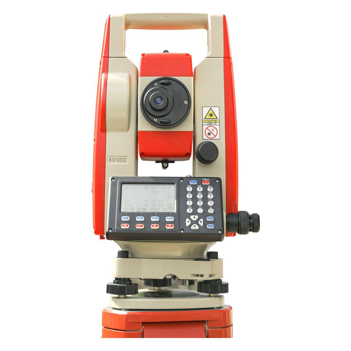 KolidaKTS-442P
Kolida KTS-442P Total Station
The workhorse of our survey counter. Reflectorless measurement, a rugged field build and a hard carry case that survives the back of a pickup.
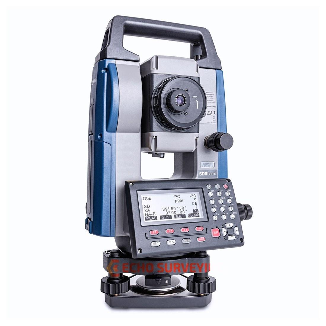 SokkiaiM-50 / iM-52 / iM-55 / iM-60 / iM-100 series
Sokkia iM Series Total Station
Japanese optics and angle measurement for control work where the tolerance is not negotiable. The iM-50, iM-55 and iM-100 series, supplied with training and calibration.
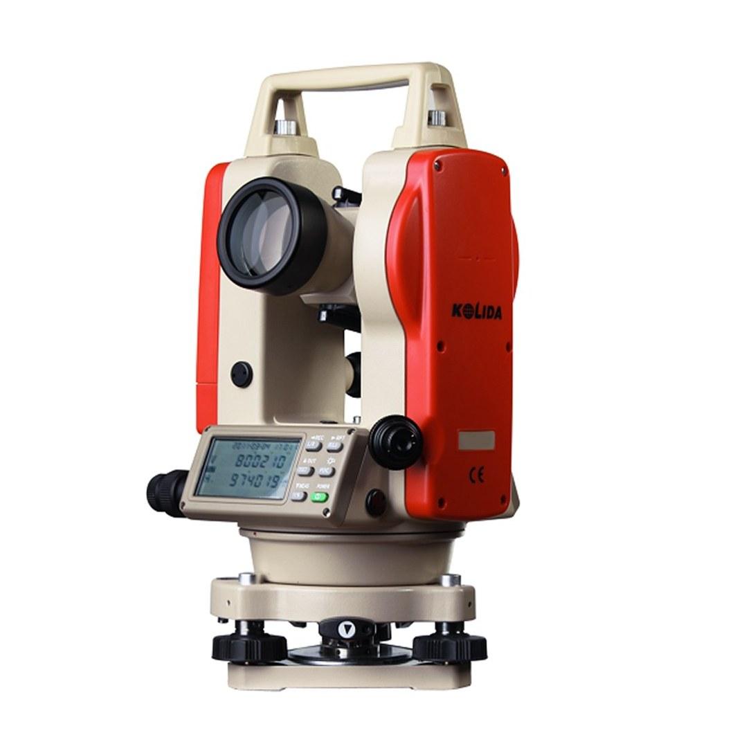 KT-02 / KT-05
Kolida KT Series Digital Theodolite
Two second and five second digital theodolites for angle work, column setting out and plumbing where a total station is more instrument than the job needs.
FAQ
Questions buyers ask us
What are the 15 surveying instruments?
The 15 in daily use in Pakistan are the total station, auto level, theodolite, GNSS RTK receiver, rotary or line laser, levelling staff, prism and pole, tripod, tribrach, handheld GPS, laser distance meter, measuring tape, mapping drone, 3D laser scanner and compass. The first five do the measuring; the rest make the measurements possible or faster.
What are the five basic surveying instruments?
The total station, the auto level, the theodolite, the GNSS receiver and the levelling staff. A total station measures angles and distances, an auto level measures height differences against a staff, a theodolite measures angles only, and GNSS fixes coordinates from satellites to about 1 to 2 cm with RTK.
Which surveying instrument is the most accurate?
For height, a good auto level run with a double-run loop beats everything else on a construction site, at about 1.5 to 2.5 mm per kilometre. For angles, a 1 or 2 second total station. For position over large areas, static GNSS at about 3 mm plus 0.1 ppm. Each is most accurate at its own job.
How much does a total station cost in Pakistan?
A Kolida KTS-442P complete set is PKR 500,000 from us as of August 2026. In the wider market, Chinese 2 second instruments run about PKR 450,000 to 800,000 and Japanese Sokkia or Topcon models about PKR 950,000 to 1,200,000. Confirm today's price on WhatsApp, rates move with the exchange rate.
What is the difference between a theodolite and a total station?
A theodolite measures horizontal and vertical angles only. A total station adds an electronic distance meter, so it measures distance too, and computes coordinates on board. A digital theodolite costs about PKR 120,000 to 250,000 against PKR 450,000 and up for a total station, which is why angle-only jobs still use one.
What surveying instruments does a small contractor need?
Start with an auto level, an aluminium tripod and a 5 metre levelling staff, which together cost about PKR 60,000 to 100,000 in the 2026 market. Add a laser distance meter for building work. Hire a crew with a total station or GNSS for setting out the plot until the workload justifies buying one.