Land survey services in Pakistan cover topographic surveys by ground crew or drone, geotechnical investigations by borehole, geophysical and water detection surveys, and setting out for construction. Shahzad Brothers runs all of these from Rawalpindi with our own Kolida and Sokkia instruments and survey-grade UAVs, across Islamabad, Punjab, KP and nationwide, and quotes each job by WhatsApp.
We have supplied survey instruments since 2002 and run our own survey crews for most of that time. That combination is unusual and it is the reason to read this guide: it is written by people who both sell the instruments and stand behind them on site. It explains what each kind of survey delivers, how a drone survey compares with a ground crew, which survey a project needs, and what to ask any survey company before you hire them.
What each survey type delivers
Topographic survey. A map of the site as it is: boundaries, levels, buildings, roads, trees, poles, drains, walls, and the ground surface as contours or a digital terrain model. Delivered as a DWG or DXF drawing on a stated coordinate system, with a control point list and a PDF plot. This is the base for every design.
Drone or UAV survey. The same topographic deliverables, produced from overlapping aerial photographs processed into an orthomosaic, a point cloud and a terrain model, with ground control points measured by RTK GNSS. Adds a georeferenced photo map of the whole site and a 3D model. Covers large areas in a fraction of the time a ground crew takes.
Geotechnical investigation. Boreholes at agreed locations and depths, standard penetration tests, disturbed and undisturbed samples, groundwater observation, and laboratory tests for classification, strength and consolidation. Delivered as a report with borehole logs, a soil profile, bearing capacity and foundation recommendations.
Geophysical survey. Electrical resistivity or seismic refraction profiles that image the subsurface without drilling: bedrock depth, cavities, soil layering, the water table. Used to plan boreholes and to cover ground between them.
Water detection survey. Resistivity sounding to locate groundwater and recommend a bore position and depth. We run these with our own multi-channel detectors for farms, housing schemes, industrial plots and tube well contractors.
Setting out and construction survey. Transferring the design to the ground: plot corners, road centrelines, building grids, levels and as-built checks. Done with total station and GNSS on site through the construction period.
How a drone survey is done and what it costs relative to a ground crew
A drone survey has four steps. First, ground control: a crew places five to fifteen marked targets across the site and measures each with RTK GNSS, which ties the aerial data to real coordinates. Second, the flight: the drone flies a planned grid at 80 to 120 metres, capturing overlapping photographs; a survey-grade unit covers 50 to 100 hectares per battery. Third, processing: photogrammetry software builds the orthomosaic, point cloud and terrain model, checked against the control points. Fourth, drafting: a surveyor extracts the features and contours into a CAD drawing.
Relative to a ground crew with a total station and GNSS:
| Ground crew | Drone survey with ground control | |
|---|---|---|
| Site of 10 acres | One day on site, one day drafting | Half a day on site, two days processing and drafting |
| Site of 500 acres | Two to three weeks on site | Two to three days on site, one week processing |
| Horizontal accuracy | 1 to 2 cm | 3 to 5 cm |
| Vertical accuracy | 1 to 2 cm | 5 to 10 cm, worse under vegetation |
| Deliverables | DWG topo, levels, control list | DWG topo, orthomosaic, point cloud, 3D model, volumes |
| Dense vegetation | Slow but sees the ground | Cannot see the ground; needs ground crew supplement |
| Earthwork volumes | Grid of levels, moderate accuracy | Full surface, high accuracy |
| Cost on small sites | Lower | Higher, processing overhead |
| Cost on large sites | Higher, crew days | Significantly lower |
The crossover is around 20 to 30 acres of open ground. Below that a ground crew is cheaper and more accurate. Above it the drone wins on cost and gives deliverables the ground crew cannot. On most large jobs we do both: drone for the surface, ground crew for the boundaries, utilities and the critical levels.
Drone flights in Pakistan need NOC clearance in many areas, especially near Rawalpindi and Islamabad. We handle the application as part of the job and build the lead time into the programme.
When you need which survey
Housing society or scheme of 50 acres and up. Drone topographic survey with ground control for the master plan, a ground crew for the boundary and existing utilities, geotechnical boreholes across the site for road and building foundations, and a water detection survey if the scheme needs its own tube wells. Later, setting out of roads and plots.
Road, canal or pipeline. A corridor topographic survey, by drone for length and ground crew for crossings and structures, with a control network along the route. Geotechnical boreholes at structures and at intervals along the alignment.
Single plot or house. A ground crew topographic survey with boundary and levels, half a day. Geotechnical investigation of one to three boreholes for anything over two storeys, and always on fill or near a nullah.
Industrial plot or factory. Topographic survey with utility detail, geotechnical investigation under the main foundations and any heavy machine bases, water detection for process water, and setting out for the building grid.
Agricultural land and farms. Drone survey for area and levelling design, water detection for tube wells.
Existing building assessment. Not a land survey; this is NDT and structural inspection, which we cover in our rebound hammer test guide.
What to ask a survey company
A land survey is only as good as the control it is built on and the instruments it was measured with. Before hiring any company, including us, ask:
- Which instruments, and when were they calibrated? The answer should name the total station, GNSS receivers and drone, and give a calibration date within the last year. A company that answers "GPS" and nothing else does not have survey-grade equipment.
- What coordinate system and datum? For Pakistan, UTM zone 42 or 43 on WGS84, or a local grid tied to known control. The drawing must state it, or no one can ever add to it.
- What exactly is delivered? A written list: file formats, contour interval, feature list, control point list, report. Agree it before the crew goes out.
- How will control be left on site? Permanent marks, nails in concrete or iron pins, with coordinates, so the contractor can set out from the same framework.
- Who signs the drawing? A named surveyor or engineer takes responsibility.
- Do they have the NOC process in hand for drone work in your area?
- Can they set out as well as survey? The firm that surveyed the site is the best placed to set it out, because the control is theirs.
Why an equipment supplier also running surveys matters
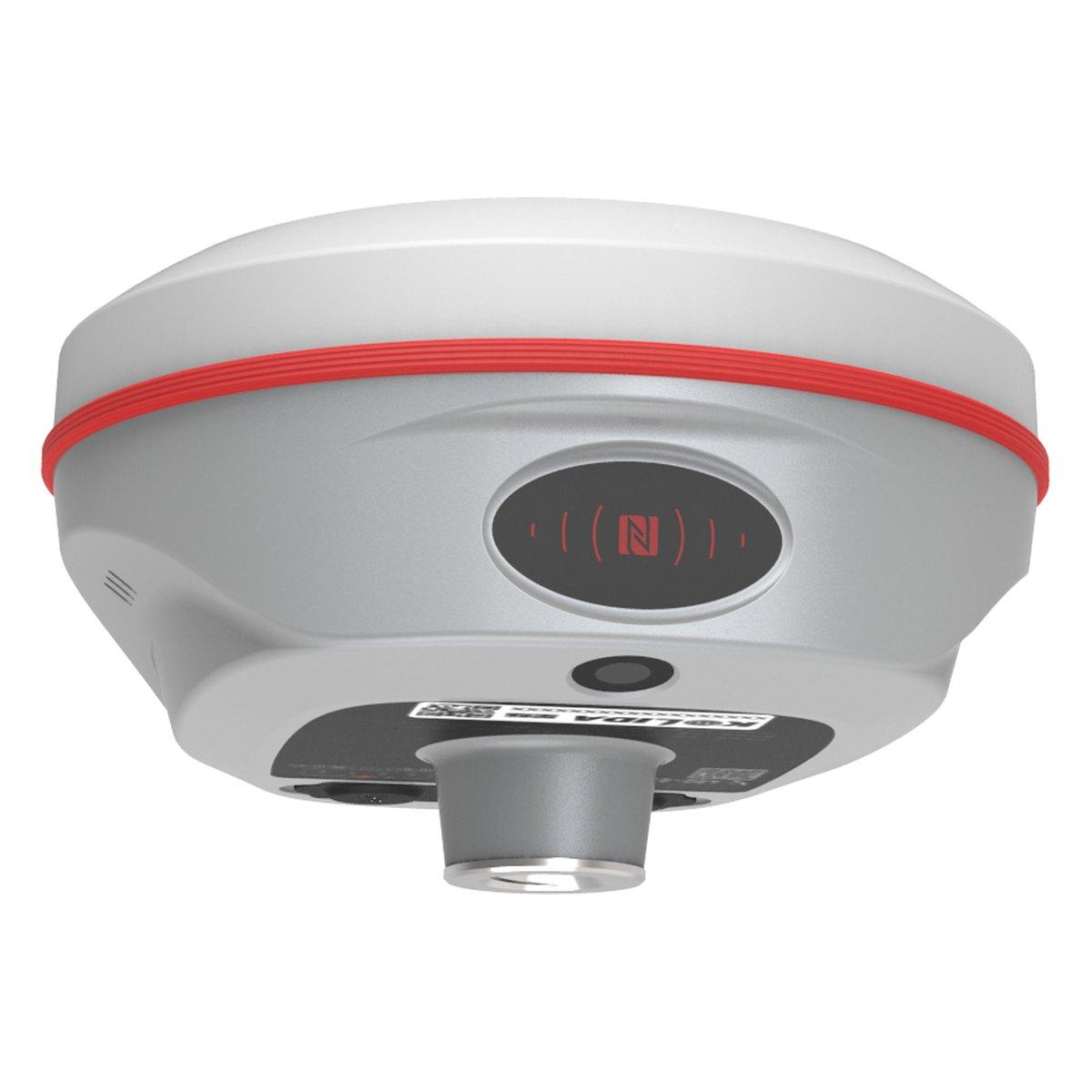
Most survey companies in Pakistan buy an instrument, use it until it fails, and send it for calibration when a consultant complains. We supply the instruments, calibrate them on our own bench, and use the same models on our own jobs. Our crews carry the Kolida K30 Pro GNSS receiver and the Kolida KTS-442P total station, and fly the survey and mapping drone we sell. When a crew reports a problem with an instrument in the field, we hear it from our own people first.
For the client this means instruments that are in calibration on the day of the survey, a written control list that a contractor with any brand of equipment can use, and a company that can supply the contractor's instruments afterwards and train them on the same framework. For a contractor or consultant buying equipment, it means advice from people who used the instrument on a site last week.
Coverage
Our crews are based at Faizabad in Rawalpindi and work daily across Rawalpindi, Islamabad and the Potohar. We cover Punjab and Khyber Pakhtunkhwa routinely, including Attock, Jhelum, Chakwal, Gujrat, Lahore, Faisalabad, Multan, Peshawar, Mardan, Abbottabad and Swat, and travel nationwide for larger jobs in Sindh, Balochistan, Gilgit-Baltistan and Azad Kashmir. Drone surveys in particular travel well: the crew, the drone and the GNSS set go in one vehicle.
What we supply
The instruments our crews carry are the ones we sell, under GPS systems and total stations.
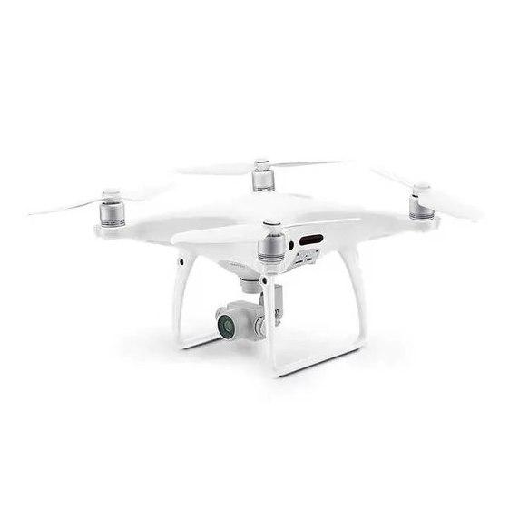
- Survey and mapping drone: the UAV we fly for topographic work.
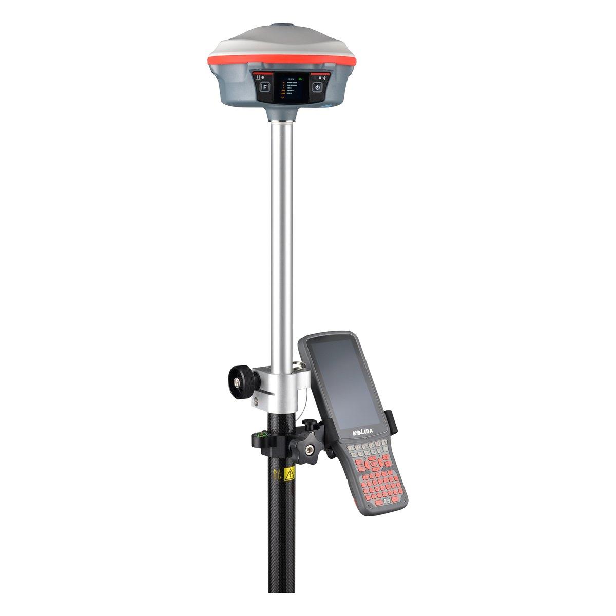
- Kolida K30 Pro GNSS receiver: the IMU rover on our crews.
- Kolida KTS-442P: the total station for detail and setting out, PKR 500,000 for the complete set.
For a buyer weighing up their own GNSS set rather than hiring a crew, our RTK GPS and GNSS receiver price in Pakistan guide gives the market ranges.
Ask for today's price
Every survey is quoted by job. Send us the site boundary as a KML, a Google Maps pin or a sketch, tell us what the survey is for and what the consultant needs, and we will quote with a programme and a deliverables list. Send us a WhatsApp and we reply during business hours.
What we supply
Equipment covered in this guide
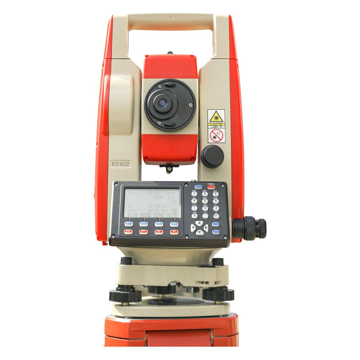 KolidaKTS-442P
Kolida KTS-442P Total Station
The workhorse of our survey counter. Reflectorless measurement, a rugged field build and a hard carry case that survives the back of a pickup.
 KolidaK30 Pro
Kolida K30 Pro GNSS RTK Receiver
A three watt radio that reaches ten to fifteen kilometres, and Star-Link correction for the sites where there is no base and no network.
Survey & Mapping Drone
RTK mapping UAVs for orthomosaics, terrain models and volumetrics. We fly them ourselves, and we supply them.
FAQ
Questions buyers ask us
What does a land survey cost in Pakistan?
It depends on area, terrain and the deliverables. A topographic survey of a few kanals by a ground crew is a day's work; a 500 acre housing society by drone with ground control takes a week including processing. We quote per job by WhatsApp after seeing the site boundary and the required outputs.
What is a topographic survey?
A topographic survey maps the natural and built features of a site with their levels: boundaries, roads, buildings, trees, utilities, drains and the ground surface as contours or a digital terrain model. It is the base drawing for every design, from a house to a motorway.
Is a drone survey accurate enough for engineering?
With ground control points measured by RTK GNSS and a survey-grade drone, horizontal accuracy of 3 to 5 cm and vertical of 5 to 10 cm is routine, which is sufficient for planning, earthwork volumes and preliminary design. For final setting out and precise levels, a ground crew still verifies the critical points.
What is a geotechnical survey?
A geotechnical investigation drills boreholes, samples the soil and rock, runs field tests such as SPT, and tests samples in the laboratory to determine bearing capacity, settlement and ground conditions for foundation design. Every building above two storeys and every bridge needs one.
Which areas do you cover?
Our crews are based in Rawalpindi and work across Islamabad, Punjab and Khyber Pakhtunkhwa routinely, and nationwide for larger jobs. Drone surveys in particular travel well; the crew, the drone and the GNSS set go in one vehicle.
What should I ask a survey company before hiring them?
Ask which instruments they use and when they were calibrated, what coordinate system and datum the drawings will be in, what the deliverables are in writing, how control will be established and left on site, and who will sign the drawings. A company that cannot answer the first question clearly should not be surveying your land.